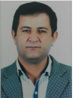
Hedayat Said Kareem Hashmi

Hedayat Hashemi
E-mail Address: [email protected]
Tel: 009647503110592
00989104404383
a. Professional Preparation
2020- …. PhD Student GIS & RS, Soran university
2007- 2010 M.Sc in GIS & RS, Tarbiat Modares
University,Tehran, IRAN
2003-2007 B.A in Physical Geography, University of Tehran, Tehran,
IRAN
1994-1998 High School Diplom in Mathematical Sciences Shahid
Mofatteh, Pre-University Collage, Mahabad, IRAN
b. Appointments
2011- Lecturer, GIS & RS, Soran
University
c. Publication
M.Sc Thesis
➢ The Spatial and Temporal Zonation of River Pollution Quality
Using Artificial Neural Network
➢ Qurtas, S. S. and H. Hashemi (2018). "Spatial and temporal
distribution of natural ponds, using GIS and remote sensing,
Northeast of Iraq." Cogent Geoscience 4(1): 1541496.
➢ Hashemi, H. & Karami, J & Amini, J and
Alimohamadi, A. Sustability Assessment of Landslide
Hazard in Lorestan Province by the Use of Topsis Fuzzy
and GIS ,Remote sensing and GIS of Iran journal,
accepted ,in publish
➢ Amini, J. & Karami, J.& hashemi, H. & Alimohamadi,
A , Evaluation of MCDM Method , AHP_OWA, AHP
,Fuzzy screening ,in Rural Complex Centers Site
Selection, Remote sensing and GIS of Iran journal,
accepted ,4, 41-51.
➢ Megari, S, & Farajzadeh, M .& Khodadadi, A & hashemi,
H., Zonation of River Pollution Quality Using Artificial
Neural Network and GIS, Remote sensing and GIS of Iran
journal, accepted , in publish
➢ Matinfar, M. & shahabi, H.& shadman, M. & Hashemi,
H., Intracity Change Detection Of Saqez City Via Remote
Sensing, presented in 6th Symposium Of Digital Earth
Pekin2009
➢ Khodadadi, A. & marzban, M. & partani, S &. Hashemi,
H., Investigation of Synthetic Pollution Sources of
Chromium as Toxic Heavy Metal in the Western North
Province of , Iran15th international conference on heavy
metals in the environment, 2010
➢ safarrad, t. & Hashemi, H & amini, j. application of
geostatistical methods in rain erosion modeling using
Fornier method, presented in GIS Symposium, malek ashtar
university, Tehran 2010
➢ Safarrad, T. & Amini, J. & Hashemi, H. , Detection Of
Snow Covering Surface Using RS & GIS, Presented in
National Geographical Science Symposium, Uremia Piam
Nur University, Uremia 2010
➢ Megari, s. & Farajzadeh, M. & khodadadi, A Hashemi, H.,
investigation in relation between Nitrogenous Compositions
and Dissolve Oxygen Using Artificial Neural Network,
Presented in 4th conference Of environmental engineering,
tehran2010
➢ Farajzadeh, M. & Megari, S. & Khodadadi, A Hashemi, H.,
Zonation of River Pollution Quality Using NSFWQI and
GIS, Presented in 4th conference Of environmental
engineering,
➢ Abdula, R. A., Abdulla, M. I., Salih, N. A., Isa, S. A., &
Hashmi, H. (2020). Hydrocarbon potentiality and
depositional environment of Naokelekan Formation in
Binari Serwan-1 Well, NE-Iraq using infrared factors and
palynological analysis evidence. Tikrit Journal of Pure
Science, 25(2), 54-63.
➢ Abdula, R. A., Al-Zubedi, A. S., & Hashmi, H. (2022).
Abnormality of geothermal gradients in Iraqi western desert
inferred from borehole temperatures. Paper presented at the
IOP Conference Series: Earth and Environmental Science.
➢ Abdula, R. A., Asaad, H. R., Qasim, O. K., Hashmi, H. S.
K., & Abdi, B. S. (2020). Volumetric Calculation of
Generated Hydrocarbon from Sargelu Formation in
Kurdistan Region, Iraq. UKH Journal of Science and
Engineering, 4(2), 166-177.
➢ Hasan Mohammed Hameed , G. R. F., Sherwan Sharif
Qurtas, Hidyat Hashemi. (2015). Impact of Urban Growth
on Groundwater Levels using Remote Sensing - Case Study:
Erbil City, Kurdistan Region of Iraq. Journal of Natural
Sciences Research, 5(18), 72-85.
➢ Khodadadi, A., Mohammadi, M. T., Partani, S., Marzban,
M., Hashemi, H., & Hayaty, M. (2013). Investigation of
polluted zones by lead in North West of Iran. Paper
presented at the E3S Web of Conferences.
➢ PARTANI, S., MOZAFAR, A. M., PARTANI, N.,
ASGHARZADEH, M., & HASHEMI, H. (2015). Hydraulic
Modeling and Erosion Vulnerability with Historical
Approach in Eastern Ancient Civilization, Elamite/Susa
Civilization in UNESCO World Heritage, Tchogha-Zanbil,
Founded 1250 BC. Paper presented at the 36th IAHR World
Congress 28 June – 3 July, 2015, The Hague, the
Netherlands.
➢ Qurtas, S. S. and H. Hashemi (2018). "Spatial and temporal
distribution of natural ponds, using GIS and remote sensing,
Northeast of Iraq." Cogent Geoscience 4(1): 1541496.
. Synergistic Activities
Job: GIS & RS expert in EAI project of the oil well exploration, in
GARMSAR, IRAN
Duration and site: Center for Biological Research, Tarbiyat Modares
University, Jan. 2009 –, Tehran Iran
The reason for quitting cooperation: Project completion
Job: GIS & RS Expert in the Identification Project of the Resources,
Consumption, and Pollution of Heavy Metal
Duration and site: the Center for Biological Research, Tarbiyat
Modares
University, March 2009 –, Tehran, Iran
The reason for quitting cooperation: Project completion
Job: GIS Expert in Environmental auditing of roads in pilot scale
Duration and site: the Center for Biological Research, Tarbiyat
Modares
University, March 2010- 2011 – Ongoing, Tehran, Iran
Job: GIS Expert in Bostano landfill EAI
Duration and site: the Center for Biological Research, Tarbiyat
Modares University, March 2011- 2012 – Ongoing, Tehran, Iran e.